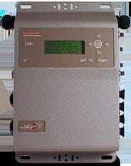
SPATIAL ECOLOGY & CONSERVATION (SPEC) LAB
  • Home
  • People
    • Alumni
    • Join us
  • Research/Data
    • Data download
    • Geospatial Plot data workflow (GeoPlot)
    • Global Aboveground biomass Potential (GAP)
    • Global Ecosystem Structure Index (GESI)
    • PARAGUAYAN PERMANENT PLOT NETWORK (PPMB)
    • 2ndFOR
    • Sustainable Tourism >
      • Lapa Rios
    • Monitoring
    • Biodiversity Frameworks
    • References
    • SPEC Lab Internal
  • GatorEye
    • Donate to GatorEye
    • Postprocessing analytics
    • Hyperspec: links & refs
    • LiDAR: links & refs
  • ORC-CCS
  • GatorEye XL
  • GatorEye Lite
    • Processing tips
  • GatorEye XTR
  • GatorEye Data Access
    • MOU
  • Teaching
    • UAS Practicum
  • Info for students
    • Templates
    • Writing resources
    • Schedule
    • Funding >
      • NASA FINESST Fellowship
  • Photos
    • Puppies
  • Directions
  • Links
    • INOGO
  • SFRC UFL
  • BigPlotNetwork
  • Osa-INOGO
  • Storm Cloud
  • CDK

Costa Rica

Picture

SOUNDSCAPES

Semi-automated analyses of high-fidelity acoustic recordings to quantify biodiversity, i.e., species abundance and composition, and habitat degradation.
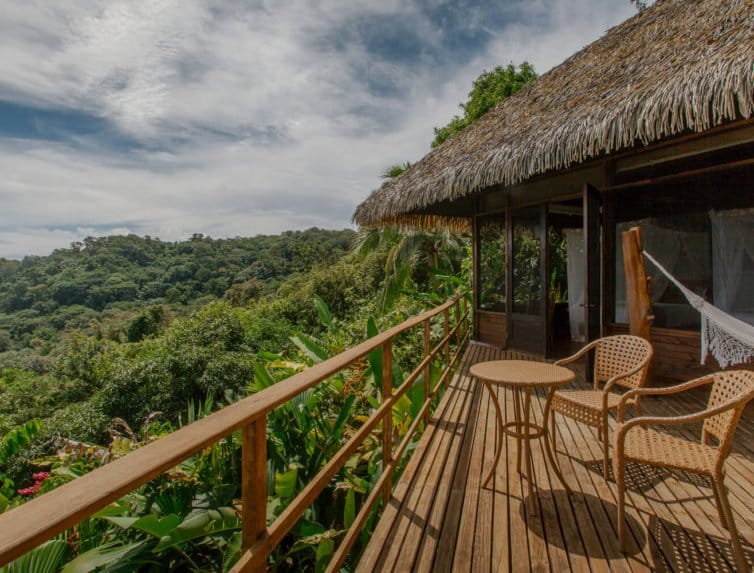
Picture

Lapa Rios Ecolodge

Linking ecotourism and biodiversity through development of 'biodiversity kiosks' coupled with ecotourist citizen scientists
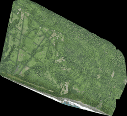
Picture

Osa Verde

Ttropical forest structure, fragmentation and restoration impacts on terrestrial wildlife composition and abundance
Picture

Osa Mapas

High resolution land cover and change mapping using segmentation analysis of RapidEye satellite- and drone-borne imagery
Picture

Osa Agua

Linking land cover and change with water quantity and quality.
Picture

 Socio-ecological framework for biodiversity monitoring

Developing and implementing framework for interdisciplinary multiple taxa monitoring of biodiversity and threats in Osa and Golfito, Costa Rica
Picture

secondary forest biomass monitoring using drone-borne lidar

Using drone-borne lidar to quantify secondary forest above-ground biomass along a successional chronosequence.
Picture

blank

To edit, click on the text to start adding your own words.
Picture

blank

To edit, click on the text to start adding your own words.

CONTACT

Center for Latin American Studies
School of Forest, Fisheries and Geomatics Sciences
University of Florida
aalmeyda@ufl.edu  / eben@ufl.edu
Picture

  • Home
  • People
    • Alumni
    • Join us
  • Research/Data
    • Data download
    • Geospatial Plot data workflow (GeoPlot)
    • Global Aboveground biomass Potential (GAP)
    • Global Ecosystem Structure Index (GESI)
    • PARAGUAYAN PERMANENT PLOT NETWORK (PPMB)
    • 2ndFOR
    • Sustainable Tourism >
      • Lapa Rios
    • Monitoring
    • Biodiversity Frameworks
    • References
    • SPEC Lab Internal
  • GatorEye
    • Donate to GatorEye
    • Postprocessing analytics
    • Hyperspec: links & refs
    • LiDAR: links & refs
  • ORC-CCS
  • GatorEye XL
  • GatorEye Lite
    • Processing tips
  • GatorEye XTR
  • GatorEye Data Access
    • MOU
  • Teaching
    • UAS Practicum
  • Info for students
    • Templates
    • Writing resources
    • Schedule
    • Funding >
      • NASA FINESST Fellowship
  • Photos
    • Puppies
  • Directions
  • Links
    • INOGO
  • SFRC UFL
  • BigPlotNetwork
  • Osa-INOGO
  • Storm Cloud
  • CDK