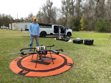
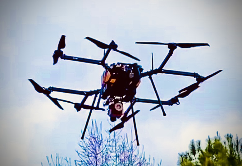
SPATIAL ECOLOGY & CONSERVATION (SPEC) LAB
  • Home
  • People
    • Join us
  • Research/Data
    • Data download
    • Geospatial Plot data workflow (GeoPlot)
    • Global Aboveground biomass Potential (GAP)
    • Global Ecosystem Structure Index (GESI)
    • PARAGUAYAN PERMANENT PLOT NETWORK (PPMB)
    • 2ndFOR
    • Sustainable Tourism >
      • Lapa Rios
    • Monitoring
    • Biodiversity Frameworks
    • References
    • SPEC Lab Internal
  • GatorEye
    • GatorEye Data Access >
      • MOU
      • Altum processing tips
    • XL
    • XTR
    • CDK
    • ORC-CS
    • ORCA-CS
    • Postprocessing analytics
    • Hyperspec: links & refs
    • LiDAR: links & refs
  • BigPlotNetwork
  • Storm Cloud
  • Teaching
    • UAS Practicum
  • Info for students
    • Templates
    • Writing resources
    • Schedule
    • Funding >
      • NASA FINESST Fellowship
  • Photos
    • Puppies
  • Directions
  • Links
  • Osa, Costa Rica
  • Donate

GatorEye XTR

Picture
The GatorEye XTR, currently in the final stages of sensor and flight system development, is used for international data collection efforts in challenging environments, such as the Peruvian Amazon or Barro Colorado Island, Panama. The GatorEye XTR is a collaboration with Phoenix Aerial and Skyfront, and integrates Phoenix Scout lidar, 61 MP visual camera,  and a Skyfront Perimeter 8 + hybrid-powered flight platform. The system, critically, is designed to enable easy transportation as checked baggage on international commercial airlines, and has undergone additional weatherproofing.

Image source: ​Source: www.unmannedsystemstechnology.com 

CONTACT

Center for Latin American Studies
School of Forest, Fisheries and Geomatics Sciences
University of Florida
aalmeyda@ufl.edu  / eben@ufl.edu
Picture

  • Home
  • People
    • Join us
  • Research/Data
    • Data download
    • Geospatial Plot data workflow (GeoPlot)
    • Global Aboveground biomass Potential (GAP)
    • Global Ecosystem Structure Index (GESI)
    • PARAGUAYAN PERMANENT PLOT NETWORK (PPMB)
    • 2ndFOR
    • Sustainable Tourism >
      • Lapa Rios
    • Monitoring
    • Biodiversity Frameworks
    • References
    • SPEC Lab Internal
  • GatorEye
    • GatorEye Data Access >
      • MOU
      • Altum processing tips
    • XL
    • XTR
    • CDK
    • ORC-CS
    • ORCA-CS
    • Postprocessing analytics
    • Hyperspec: links & refs
    • LiDAR: links & refs
  • BigPlotNetwork
  • Storm Cloud
  • Teaching
    • UAS Practicum
  • Info for students
    • Templates
    • Writing resources
    • Schedule
    • Funding >
      • NASA FINESST Fellowship
  • Photos
    • Puppies
  • Directions
  • Links
  • Osa, Costa Rica
  • Donate